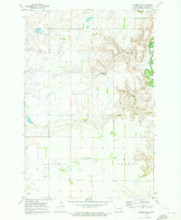
1970 Map of Sanborn SE
USGS Topo · Published 1973About this map
The Sheyenne River winds through the eastern edge of this landscape, its steep-sided valley contrasting sharply with the agricultural plateaus of Skandia and Nelson townships. This 1970 field-checked survey reveals a rural territory defined by section-line roads and sparse but significant landmarks. Near the center of the sheet, the Ringsaker Cem serves as a key point for genealogists and local historians, while the sprawling Green Marsh and several Gravel Pit operations highlight the area's drainage patterns and surface geology. A solitary Radio Tower stands in Green township, a modern fixture in a region otherwise dominated by traditional township boundaries and farm-to-market infrastructure. The detailed topography illustrates the transition from the high prairie down to the river bottomlands, providing a clear view of the area's drainage and land-use divisions.
Find a feature on this map
9 named features on this map. Tap any name to fly to it.
Don’t see what you’re looking for? This feature index may not catch every label — zoom into the map to look around manually.
Map Details
Editions of this 1970 Sanborn SE Map
This is the sole edition of this map. No revisions or reprints were ever made.
Other maps of this area

1897 · Tower
USGS Topo · 1:125,000

1897 · Eckelson
USGS Topo · 1:125,000

1953 · Jamestown
USGS Topo · 1:250,000

1953 · Fargo
USGS Topo · 1:250,000

1956 · Fargo
USGS Topo · 1:250,000

1956 · Jamestown
USGS Topo · 1:250,000

1961 · Valley City East
USGS Topo · 1:24,000

1961 · Valley City West
USGS Topo · 1:24,000

1967 · Fingal SW
USGS Topo · 1:24,000
1967 · Kathryn
USGS Topo · 1:24,000