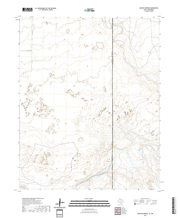
2022 Map of Sanchez Springs
USGS Topo · Published 2022About this map
The Canadian River cuts through the southeastern corner of this High Plains landscape, marking a significant hydrologic transition along the border of Texas and New Mexico. This region in Oldham County is defined by intermittent drainage patterns and cattle-country infrastructure, where seasonal water sources like the Nara Visa Arroyo and Sanchez Tank supported ranching operations. The rugged breaks leading toward the river valley are punctuated by isolated reliable water points, most notably Sanchez Spring. The map documents the vast, surveyed sections typical of the western Llano Estacado, tied together by a sparse network of section-line roads including Quay Road F and Quay Rd 84 that connect these remote grazing lands to the larger regional trade routes.
Find a feature on this map
14 named features on this map. Tap any name to fly to it.
Don’t see what you’re looking for? This feature index may not catch every label — zoom into the map to look around manually.
Map Details
Editions of this 2022 Sanchez Springs Map
This is the sole edition of this map. No revisions or reprints were ever made.
Other maps of this area

1954 · Tucumcari
USGS Topo · 1:250,000

1958 · Tucumcari
USGS Topo · 1:250,000

1966 · Signal Spring
USGS Topo · 1:24,000

1966 · Trujillo Camp
USGS Topo · 1:24,000

1968 · Blue Hole
USGS Topo · 1:24,000

1968 · Cammak Camp
USGS Topo · 1:24,000

1968 · Sanchez Springs
USGS Topo · 1:24,000
1968 · Martin Draw
USGS Topo · 1:24,000

1971 · Obar
USGS Topo · 1:24,000

1971 · Nara Visa
USGS Topo · 1:24,000