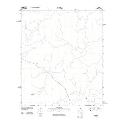
2010 Map of Sanco
USGS Topo · Published 2010About this map
The settlement of Sanco anchors this portion of Coke County, where the high plains of West Texas meet the broken terrain of the Colorado River watershed. The landscape is defined by a series of prominent rises including Durham Peak, Horse Mountain, and Meadow Mountain, which overlook a network of seasonal watercourses. Tributaries such as Yellow Wolf Creek and Willmo Sand Creek carve through the scrubland, while Panther Gap provides a natural passage through the elevated ridges. The road network, including the Sanco Loop and Arledge Rd, reflects a rural ranching economy where property boundaries often follow the winding paths of Rough Creek and Meadow Creek. This survey captures the region's sparse development, focusing on the essential relationship between the intermittent water supply and the isolated ranching outposts that characterize the area.
Find a feature on this map
15 named features on this map. Tap any name to fly to it.
Don’t see what you’re looking for? This feature index may not catch every label — zoom into the map to look around manually.
Map Details
Editions of this 2010 Sanco Map
This is the sole edition of this map. No revisions or reprints were ever made.
Other maps of this area

1891 · Hayrick
USGS Topo · 1:125,000

1893 · Sweetwater
USGS Topo · 1:125,000

1894 · Hayrick
USGS Topo · 1:125,000

1954 · Big Spring
USGS Topo · 1:250,000

1954 · San Angelo
USGS Topo · 1:250,000

1958 · San Angelo
USGS Topo · 1:250,000

1958 · Big Spring
USGS Topo · 1:250,000

1959 · Dam Draw
USGS Topo · 1:24,000

1959 · Silver
USGS Topo · 1:24,000

1962 · Edith
USGS Topo · 1:24,000