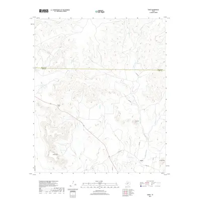
2019 Map of Sanco
USGS Topo · Published 2019About this map
Sanco remains the primary settlement point in this stretch of West Texas, positioned near the southern end of the map where Sanco Loop meets the local road network. The landscape is defined by its drainage systems and prominent elevations, such as Meadow Mtn and Horse Mtn, which rise above the surrounding plains. A sophisticated network of intermittent watercourses, including Yellow Wolf Creek, Meadow Cr, and Rough Cr, carves through the terrain, illustrating the hydrologic character of the region. The boundary between Nolan County and Coke County bisects the upper portion of the map, marking a transition in local jurisdiction across the open ranch land. Distinctive topographic features like Panther Gap and Durham Peak provide clear navigational landmarks for those studying the area's physical geography or local history.
Find a feature on this map
18 named features on this map. Tap any name to fly to it.
Don’t see what you’re looking for? This feature index may not catch every label — zoom into the map to look around manually.
Map Details
Editions of this 2019 Sanco Map
This is the sole edition of this map. No revisions or reprints were ever made.
Other maps of this area

1891 · Hayrick
USGS Topo · 1:125,000

1893 · Sweetwater
USGS Topo · 1:125,000

1894 · Hayrick
USGS Topo · 1:125,000

1954 · Big Spring
USGS Topo · 1:250,000

1954 · San Angelo
USGS Topo · 1:250,000

1958 · San Angelo
USGS Topo · 1:250,000

1958 · Big Spring
USGS Topo · 1:250,000

1959 · Dam Draw
USGS Topo · 1:24,000

1959 · Silver
USGS Topo · 1:24,000

1962 · Edith
USGS Topo · 1:24,000