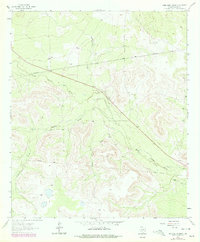
1963 Map of Sand Bluff Draw
USGS Topo · Published 1978About this map
North Concho River winds through this West Texas landscape, shaping a network of intermittent drainages including Sand Bluff Draw and Dobson Creek. The terrain is defined by large pastoral holdings such as the McEntire Ranch and Cole Ranch, illustrating the ranching economy of Sterling County during the mid-20th century. While most of the area remains open rangeland, industrial infrastructure is evident through the series of pipelines crossing the territory. Pockets of activity are concentrated around features like the Landing Strip and a small Quarry, suggesting the multi-use nature of these lands. The presence of Roadside Park along the primary roadway and landmarks like Reed provide points of orientation within the expansive draws of the Concho basin.
Find a feature on this map
15 named features on this map. Tap any name to fly to it.
Don’t see what you’re looking for? This feature index may not catch every label — zoom into the map to look around manually.
Map Details
Editions of this 1963 Sand Bluff Draw Map
2 editions found
Other maps of this area

1941 · Big Spring South
USGS Topo · 1:62,500

1942 · Big Spring South
USGS Topo · 1:62,500

1954 · Big Spring
USGS Topo · 1:250,000

1954 · San Angelo
USGS Topo · 1:250,000

1958 · San Angelo
USGS Topo · 1:250,000

1958 · Big Spring
USGS Topo · 1:250,000

1963 · Cumbie Draw
USGS Topo · 1:24,000

1963 · Glass Ranch
USGS Topo · 1:24,000

1963 · Cumbie Draw NE
USGS Topo · 1:24,000

1963 · Buffalo Draw
USGS Topo · 1:24,000