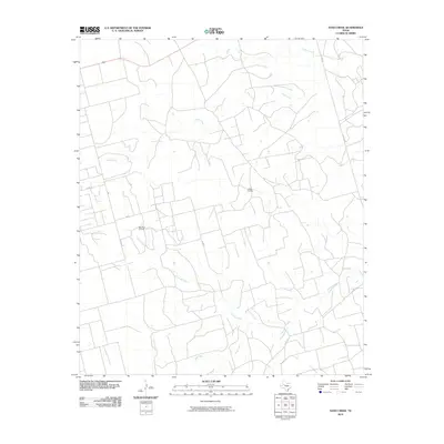
2010 Map of Sand Creek
USGS Topo · Published 2010About this map
Colorado River headwaters wind through this West Texas landscape, defining a network of drainage basins that include Sand Creek, Tobacco Creek, and Gold Creek. The terrain is marked by the industrial footprint of the Permian Basin, where the Jo Mill Oil Field and Spraberry Oil Field indicate the extensive petroleum extraction activities of the era. A grid of local roads, such as Outlaw Rd and Co Rd 224, provides access to these remote operations and agricultural holdings. This survey captures a moment in the early 21st century when energy production and traditional ranching geography remained the dominant features of the region, evidenced by the numerous unnamed farm tanks and secondary roads serving the oil fields.
Find a feature on this map
13 named features on this map. Tap any name to fly to it.
Don’t see what you’re looking for? This feature index may not catch every label — zoom into the map to look around manually.
Map Details
Editions of this 2010 Sand Creek Map
This is the sole edition of this map. No revisions or reprints were ever made.
Other maps of this area

1954 · Big Spring
USGS Topo · 1:250,000

1958 · Big Spring
USGS Topo · 1:250,000

1968 · Hancock
USGS Topo · 1:24,000

1969 · Indian Canyon
USGS Topo · 1:24,000

1969 · Holloway Canyon
USGS Topo · 1:24,000

1970 · Vealmoor
USGS Topo · 1:24,000

1970 · Ackerly
USGS Topo · 1:24,000

1970 · Key
USGS Topo · 1:24,000

1970 · Sand Creek
USGS Topo · 1:24,000
1970 · Sparenberg
USGS Topo · 1:24,000