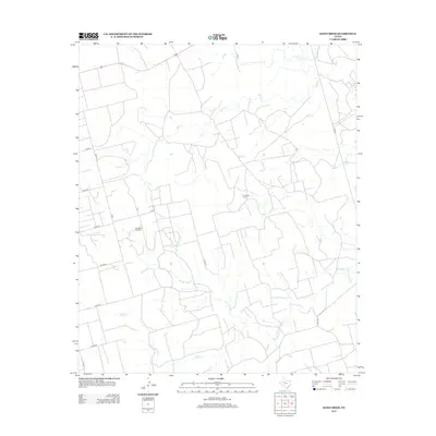
2012 Map of Sand Creek
USGS Topo · Published 2012About this map
The Colorado River winds through this West Texas landscape, defining the hydrology of an area marked by extensive petroleum extraction and a network of rural county roads. During this period, the Jo Mill Oil Field and Spraberry Oil Field dominate the local economy and land use, with numerous access roads like Co RD-25 and Co RD-21 connecting the drilling sites. The terrain is further drained by several seasonal waterways, including Sand Cr in the north and Gold Cr to the south. This survey reflects the modern industrial character of the region, where the traditional ranching landscape is crisscrossed by energy infrastructure and significant routes such as FM-1054 and US Route 180.
Find a feature on this map
21 named features on this map. Tap any name to fly to it.
Don’t see what you’re looking for? This feature index may not catch every label — zoom into the map to look around manually.
Map Details
Editions of this 2012 Sand Creek Map
This is the sole edition of this map. No revisions or reprints were ever made.
Other maps of this area

1954 · Big Spring
USGS Topo · 1:250,000

1958 · Big Spring
USGS Topo · 1:250,000

1968 · Hancock
USGS Topo · 1:24,000

1969 · Indian Canyon
USGS Topo · 1:24,000

1969 · Holloway Canyon
USGS Topo · 1:24,000

1970 · Vealmoor
USGS Topo · 1:24,000

1970 · Ackerly
USGS Topo · 1:24,000

1970 · Key
USGS Topo · 1:24,000

1970 · Sand Creek
USGS Topo · 1:24,000
1970 · Sparenberg
USGS Topo · 1:24,000