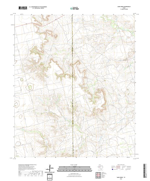
2022 Map of Sand Creek
USGS Topo · Published 2022About this map
The Colorado River meanders across this West Texas landscape, cutting through the high plains at the boundary of Dawson and Borden Counties. This region is defined by a network of drainage features that feed the river system, including Sand Cr, Gold Cr, and the smaller Tobacco Cr. The topography reveals the intricate erosion of the Caprock, where landmarks like Buck Canyon, Coon Hollow, and Crane Draw illustrate the deep carving of the terrain by seasonal water flow.
Find a feature on this map
22 named features on this map. Tap any name to fly to it.
Don’t see what you’re looking for? This feature index may not catch every label — zoom into the map to look around manually.
Map Details
Editions of this 2022 Sand Creek Map
This is the sole edition of this map. No revisions or reprints were ever made.
Other maps of this area

1954 · Big Spring
USGS Topo · 1:250,000

1958 · Big Spring
USGS Topo · 1:250,000

1968 · Hancock
USGS Topo · 1:24,000

1969 · Indian Canyon
USGS Topo · 1:24,000

1969 · Holloway Canyon
USGS Topo · 1:24,000

1970 · Vealmoor
USGS Topo · 1:24,000

1970 · Ackerly
USGS Topo · 1:24,000

1970 · Key
USGS Topo · 1:24,000

1970 · Sand Creek
USGS Topo · 1:24,000
1970 · Sparenberg
USGS Topo · 1:24,000