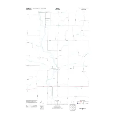
2013 Map of Sand Creek
USGS Topo · Published 2013About this map
The Red Cedar River serves as the central artery of this Dunn County landscape, carving a braided path through the valley where the settlement of Sand Creek is situated. This region is defined by its complex network of watercourses, including Hay Cr, Beaver Cr, and Lower Pine Cr, which drain the surrounding agricultural lands. The map illustrates a strictly organized grid of rural avenues and streets, such as 1450th Ave and 930th St, that facilitate movement between small farms and local hubs.
Find a feature on this map
62 named features on this map. Tap any name to fly to it.
Don’t see what you’re looking for? This feature index may not catch every label — zoom into the map to look around manually.
Map Details
Editions of this 2013 Sand Creek Map
This is the sole edition of this map. No revisions or reprints were ever made.
Other maps of this area

1949 · New Auburn
USGS Topo · 1:62,500

1949 · Ridgeland
USGS Topo · 1:62,500

1951 · Ridgeland
USGS Topo · 1:62,500

1951 · New Auburn
USGS Topo · 1:62,500

1951 · Chetek
USGS Topo · 1:62,500

1951 · Barron
USGS Topo · 1:62,500

1953 · Rice Lake
USGS Topo · 1:250,000

1959 · Rice Lake
USGS Topo · 1:250,000
1975 · Colfax North
USGS Topo · 1:24,000
1975 · New Auburn
USGS Topo · 1:24,000