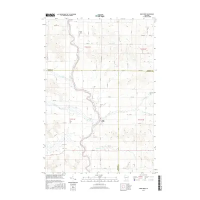
2015 Map of Sand Creek
USGS Topo · Published 2015About this map
The Red Cedar River carves a winding path through this western Wisconsin landscape, serving as the primary geographic anchor for the settlement of Sand Creek. This 2015 survey reveals a deeply agricultural region defined by a precise grid of rural routes like 1450th Ave and Lundquist Hill Rd that cross the boundaries of Barron, Dunn, and Chippewa Counties.
Find a feature on this map
77 named features on this map. Tap any name to fly to it.
Don’t see what you’re looking for? This feature index may not catch every label — zoom into the map to look around manually.
Map Details
Editions of this 2015 Sand Creek Map
This is the sole edition of this map. No revisions or reprints were ever made.
Other maps of this area

1949 · New Auburn
USGS Topo · 1:62,500

1949 · Ridgeland
USGS Topo · 1:62,500

1951 · Ridgeland
USGS Topo · 1:62,500

1951 · New Auburn
USGS Topo · 1:62,500

1951 · Chetek
USGS Topo · 1:62,500

1951 · Barron
USGS Topo · 1:62,500

1953 · Rice Lake
USGS Topo · 1:250,000

1959 · Rice Lake
USGS Topo · 1:250,000
1975 · Colfax North
USGS Topo · 1:24,000
1975 · New Auburn
USGS Topo · 1:24,000