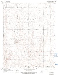
1966 Map of Sand Creek
USGS Topo · Published 1993About this map
The arid high plains of western Kansas take center stage on this 1966 survey, where the dry beds of Sand Creek and Syracuse Creek carve deep, winding incisions through the township of Liberty. The landscape is defined by its industrial and agricultural utility rather than settlement, showing a network of ranch roads and section lines typical of the region's cattle and energy economy. Scattered Gas Well sites and Sandpits are primary indicators of local resource extraction during this era.
Find a feature on this map
9 named features on this map. Tap any name to fly to it.
Don’t see what you’re looking for? This feature index may not catch every label — zoom into the map to look around manually.
Map Details
Editions of this 1966 Sand Creek Map
2 editions found
Other maps of this area

1900 · Syracuse
USGS Topo · 1:125,000

1920 · Syracuse
USGS Topo · 1:125,000

1955 · Dodge City
USGS Topo · 1:250,000

1955 · Scott City
USGS Topo · 1:250,000

1958 · Dodge City
USGS Topo · 1:250,000

1958 · Scott City
USGS Topo · 1:250,000

1959 · Dodge City
USGS Topo · 1:250,000

1966 · Syracuse East
USGS Topo · 1:24,000
1966 · Syracuse West
USGS Topo · 1:24,000

1966 · Tribune 4 NW
USGS Topo · 1:24,000