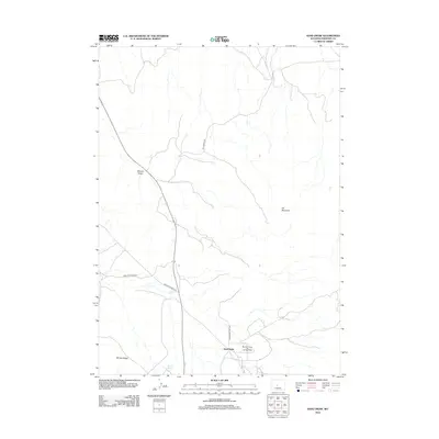
2012 Map of Sand Draw
USGS Topo · Published 2012About this map
Big Sand Draw Oil and Gas Field defines the industrial character of this Fremont County landscape, situated just east of the small settlement at Sand Draw. The 2012 topography reveals a high-desert environment where resource extraction is the primary human footprint, marked by the extensive network of service roads like Oil Springs Rd and Sand Draw Field Rd. Natural landmarks punctuate the terrain, providing essential orientation points in an otherwise sparse basin. These include the prominent Oil Mountain to the east and the long stretch of McTurk Ridge in the southwest. A single water source, Carlson Spring, is noted near the ridge, highlighting the importance of isolated springs in this arid region. The presence of Bringoff Ranch Rd suggests the area's dual history of ranching alongside its more prominent energy production.
Find a feature on this map
9 named features on this map. Tap any name to fly to it.
Don’t see what you’re looking for? This feature index may not catch every label — zoom into the map to look around manually.
Map Details
Editions of this 2012 Sand Draw Map
This is the sole edition of this map. No revisions or reprints were ever made.
Other maps of this area

1953 · Blue Gulch
USGS Topo · 1:24,000

1953 · Arapahoe NE
USGS Topo · 1:24,000

1953 · Bringolf Ranch
USGS Topo · 1:24,000

1953 · Elkhorn Springs
USGS Topo · 1:24,000

1953 · Campbell Ridge
USGS Topo · 1:24,000

1953 · Sand Draw
USGS Topo · 1:24,000

1953 · Dishpan Butte
USGS Topo · 1:24,000

1953 · Yellowstone Ranch
USGS Topo · 1:24,000

1955 · Lander
USGS Topo · 1:250,000

1958 · Lander
USGS Topo · 1:250,000