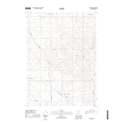
2018 Map of Sand Draw
USGS Topo · Published 2018About this map
Sand Draw stands as the primary point of settlement in this arid landscape of south-central Wyoming, where industrial activity and ranching intersect. The terrain is defined by a complex network of ephemeral watercourses including Bobcat Draw, Carter Draw, and Big Sand Draw, which carve through the high-elevation basin. These geographical features reflect the region's historical reliance on the petroleum and ranching industries, with infrastructure like Oil Springs Rd and Sand Draw Field Rd providing access to the various draws and ridges. Local landmarks such as Oil Mtn and McTurk Ridge serve as distinctive topographic anchors for the surrounding territory. For those tracing the water sources vital to early habitation, Carlson Spring provides a rare point of named hydrology among the many dry draws that define the Fremont County topography.
Find a feature on this map
20 named features on this map. Tap any name to fly to it.
Don’t see what you’re looking for? This feature index may not catch every label — zoom into the map to look around manually.
Map Details
Editions of this 2018 Sand Draw Map
This is the sole edition of this map. No revisions or reprints were ever made.
Other maps of this area

1953 · Blue Gulch
USGS Topo · 1:24,000

1953 · Arapahoe NE
USGS Topo · 1:24,000

1953 · Bringolf Ranch
USGS Topo · 1:24,000

1953 · Elkhorn Springs
USGS Topo · 1:24,000

1953 · Campbell Ridge
USGS Topo · 1:24,000

1953 · Sand Draw
USGS Topo · 1:24,000

1953 · Dishpan Butte
USGS Topo · 1:24,000

1953 · Yellowstone Ranch
USGS Topo · 1:24,000

1955 · Lander
USGS Topo · 1:250,000

1958 · Lander
USGS Topo · 1:250,000