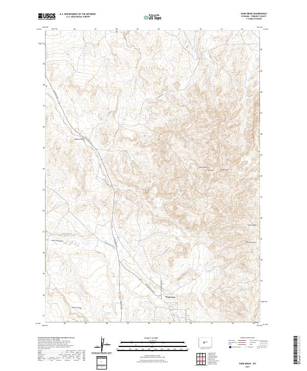
2021 Map of Sand Draw
USGS Topo · Published 2021About this map
Sand Draw stands as the primary human landmark in this part of Fremont County, situated where the high desert terrain meets a network of intermittent watercourses and ridges. The landscape is defined by its drainage patterns, with Little Sand Draw and Big Sand Draw carving paths through the territory toward the McTurk Ridge area. These natural features dictated the early movement of cattle and equipment across this part of the Wyoming interior.
Find a feature on this map
20 named features on this map. Tap any name to fly to it.
Don’t see what you’re looking for? This feature index may not catch every label — zoom into the map to look around manually.
Map Details
Editions of this 2021 Sand Draw Map
This is the sole edition of this map. No revisions or reprints were ever made.
Other maps of this area

1953 · Blue Gulch
USGS Topo · 1:24,000

1953 · Arapahoe NE
USGS Topo · 1:24,000

1953 · Bringolf Ranch
USGS Topo · 1:24,000

1953 · Elkhorn Springs
USGS Topo · 1:24,000

1953 · Campbell Ridge
USGS Topo · 1:24,000

1953 · Sand Draw
USGS Topo · 1:24,000

1953 · Dishpan Butte
USGS Topo · 1:24,000

1953 · Yellowstone Ranch
USGS Topo · 1:24,000

1955 · Lander
USGS Topo · 1:250,000

1958 · Lander
USGS Topo · 1:250,000