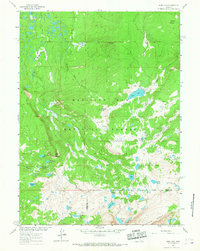
1961 Map of Sand Lake
USGS Topo · Published 1967About this map
Medicine Bow National Forest dominates this high-altitude landscape in the early 1960s, defined by its complex network of glacial lakes and headwater streams. The boundary between Carbon and Albany counties runs through the southern reaches of the map, cutting across several remote water bodies including Quealy Lake and Reservoir Lake. The era’s land management and recreational development are evident through the presence of the Carlson Park Guard Sta and the Deep Creek Campground, positioned along the drainage of Deep Creek.
Find a feature on this map
44 named features on this map. Tap any name to fly to it.
Don’t see what you’re looking for? This feature index may not catch every label — zoom into the map to look around manually.
Map Details
Editions of this 1961 Sand Lake Map
3 editions found
Other maps of this area

1906 · Medicine Bow
USGS Topo · 1:125,000

1908 · Medicine Bow
USGS Topo · 1:125,000

1954 · Rawlins
USGS Topo · 1:250,000

1955 · Elk Mountain SW
USGS Topo · 1:24,000

1958 · Rawlins
USGS Topo · 1:250,000

1958 · White Rock Canyon
USGS Topo · 1:24,000

1958 · Arlington
USGS Topo · 1:24,000

1961 · Sand Lake
USGS Topo · 1:24,000

1961 · Medicine Bow Peak
USGS Topo · 1:24,000
1961 · Phantom Lake
USGS Topo · 1:24,000