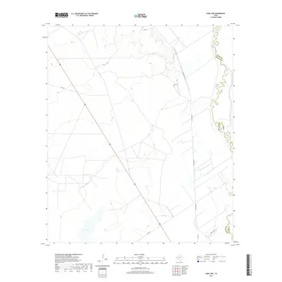
2019 Map of Sand Lake
USGS Topo · Published 2019About this map
The Pecos River carves a highly sinuous boundary between Reeves and Ward counties, anchoring this landscape of West Texas rangeland. In this late 2010s survey, the winding waterway contrasts sharply with the rigid, geometric grid of rural routes such as N Roberson Rd and Ranch Rd 1216. Significant for local genealogy, the Lara Cem sits along Lara Rd, preserving a small pocket of family history within the vast drainage area. The southern reaches are defined by the ephemeral basin of Sand Lake, a notable hydrologic landmark in a region where water features significantly influence settlement patterns and land use. This topographic study captures the intersection of natural riverine cycles and the modern roadway network used by local ranching communities.
Find a feature on this map
10 named features on this map. Tap any name to fly to it.
Don’t see what you’re looking for? This feature index may not catch every label — zoom into the map to look around manually.
Map Details
Editions of this 2019 Sand Lake Map
This is the sole edition of this map. No revisions or reprints were ever made.
Other maps of this area

1921 · Toyah
USGS Topo · 1:125,000

1931 · Barstow
USGS Topo · 1:125,000

1954 · Pecos
USGS Topo · 1:250,000

1957 · Pecos
USGS Topo · 1:250,000

1961 · Soda Lake
USGS Topo · 1:24,000

1961 · Mentone
USGS Topo · 1:24,000

1961 · Anderson Ranch
USGS Topo · 1:24,000

1961 · Sand Lake
USGS Topo · 1:24,000

1963 · Pecos East
USGS Topo · 1:24,000

1967 · Soda Lake NW
USGS Topo · 1:24,000