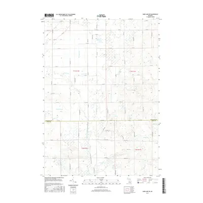
2017 Map of Sand Lake SW
USGS Topo · Published 2017About this map
The Rogue River meanders southward through this West Michigan landscape, marking a boundary between the agricultural and forested lands of the Newaygo and Kent County line. This area is characterized by an intricate network of drainage systems such as Plaiser Drain, Costen Drain, and Veenboer Drain, which reflect the region's managed hydrology and its historical transformation for farming. The presence of the North Country National Scenic Trail cutting through the center of the sheet highlights the transition from rural township roads to protected recreational corridors. To the east and south, a cluster of kettle lakes including Ransom Lake, Frey Lake, and Chrishaven Lake dot the glacial topography. Small-scale named landmarks such as Cook and White Lake and Baldwin Lake provide specific points of interest for local historians and land researchers studying the legacy of family names and water rights in this portion of the state.
Find a feature on this map
77 named features on this map. Tap any name to fly to it.
Don’t see what you’re looking for? This feature index may not catch every label — zoom into the map to look around manually.
Map Details
Editions of this 2017 Sand Lake SW Map
This is the sole edition of this map. No revisions or reprints were ever made.
Other maps of this area

1918 · Cedar Springs
USGS Topo · 1:62,500

1943 · Cedar Springs
USGS Topo · 1:62,500

1945 · Ravenna
USGS Topo · 1:62,500

1954 · Midland
USGS Topo · 1:250,000

1958 · Midland
USGS Topo · 1:250,000

1958 · Sand Lake
USGS Topo · 1:62,500

1958 · Fremont
USGS Topo · 1:62,500

1959 · Midland
USGS Topo · 1:250,000

1966 · Midland
USGS Topo · 1:250,000

1967 · Sparta
USGS Topo · 1:24,000