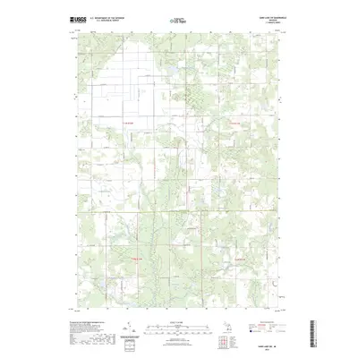
2023 Map of Sand Lake SW
USGS Topo · Published 2023About this map
The Rogue River meanders southward through the transition between Newaygo and Kent counties, defining a landscape marked by a complex network of glacial lakes and agricultural drainage systems. This 2023 survey illustrates the local reliance on managed water features like the Costen Drain, Veenboer Drain, and Hiltbrand Drain to support the surrounding farmlands. The terrain is dotted with numerous small bodies of water, including Moore Lake, Frey Lake, Baldwin Lake, and the larger Chrishaven Lake paired with Spring Lake.
Find a feature on this map
50 named features on this map. Tap any name to fly to it.
Don’t see what you’re looking for? This feature index may not catch every label — zoom into the map to look around manually.
Map Details
Editions of this 2023 Sand Lake SW Map
This is the sole edition of this map. No revisions or reprints were ever made.
Other maps of this area

1918 · Cedar Springs
USGS Topo · 1:62,500

1943 · Cedar Springs
USGS Topo · 1:62,500

1945 · Ravenna
USGS Topo · 1:62,500

1954 · Midland
USGS Topo · 1:250,000

1958 · Midland
USGS Topo · 1:250,000

1958 · Sand Lake
USGS Topo · 1:62,500

1958 · Fremont
USGS Topo · 1:62,500

1959 · Midland
USGS Topo · 1:250,000

1966 · Midland
USGS Topo · 1:250,000

1967 · Sparta
USGS Topo · 1:24,000