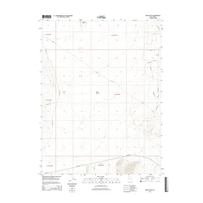
2014 Map of Sand Pass NE
USGS Topo · Published 2014About this map
Fish Springs Flat and the adjacent Fish Flat define the low-lying desert floor of this corner of Juab County. The landscape is marked by the drainage patterns of Fish Springs Wash and Swasey Knolls Wash, which cut through the arid basin. Though the region is largely open range, a network of tracks such as Windmill Rd and Field Rd suggests long-standing ranching or grazing use. More modern infrastructure is present in the form of the Landing Strip and named corridors like Almstedt Rd and Robyn Rd on the eastern edge. The southern portion is traversed by Weiss Hwy, a primary transit artery through this remote desert expanse, while the Fish Springs Rd provides a north-south connection across the flats.
Find a feature on this map
27 named features on this map. Tap any name to fly to it.
Don’t see what you’re looking for? This feature index may not catch every label — zoom into the map to look around manually.
Map Details
Editions of this 2014 Sand Pass NE Map
This is the sole edition of this map. No revisions or reprints were ever made.
Other maps of this area

1908 · Fish Springs
USGS Topo · 1:250,000

1910 · Fish Springs
USGS Topo · 1:250,000

1953 · Dugway Range
USGS Topo · 1:62,500

1953 · Topaz Mtn
USGS Topo · 1:62,500

1953 · Delta
USGS Topo · 1:250,000

1958 · Delta
USGS Topo · 1:250,000

1962 · Delta
USGS Topo · 1:250,000

1967 · Sand Pass
USGS Topo · 1:24,000

1967 · Sand Pass NW
USGS Topo · 1:24,000

1967 · Sand Pass SE
USGS Topo · 1:24,000