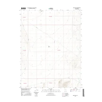
2017 Map of Sand Pass NE
USGS Topo · Published 2017About this map
Fish Springs Flat dominates this 2017 landscape in Juab County, where the topography reveals a wide, arid basin flanked by subtle desert drainages. The area is defined by its drainage patterns, notably Fish Springs Wash in the north and the winding Swasey Knolls Wash to the southeast. Human presence is marked primarily by a sparse network of desert roads and tracks, such as Weis Hwy and Sand Pass Rd, which provide access across the open terrain. A specific landmark, Brush Well, appears near the northern boundary, suggesting a critical water point or historical outpost for the region's ranching or travel history. The map illustrates the characteristic basin-and-range geography of western Utah, where vast flatlands are etched by seasonal washes and connected by long, isolated thoroughfares like Field Rd.
Find a feature on this map
13 named features on this map. Tap any name to fly to it.
Don’t see what you’re looking for? This feature index may not catch every label — zoom into the map to look around manually.
Map Details
Editions of this 2017 Sand Pass NE Map
This is the sole edition of this map. No revisions or reprints were ever made.
Other maps of this area

1908 · Fish Springs
USGS Topo · 1:250,000

1910 · Fish Springs
USGS Topo · 1:250,000

1953 · Dugway Range
USGS Topo · 1:62,500

1953 · Topaz Mtn
USGS Topo · 1:62,500

1953 · Delta
USGS Topo · 1:250,000

1958 · Delta
USGS Topo · 1:250,000

1962 · Delta
USGS Topo · 1:250,000

1967 · Sand Pass
USGS Topo · 1:24,000

1967 · Sand Pass NW
USGS Topo · 1:24,000

1967 · Sand Pass SE
USGS Topo · 1:24,000