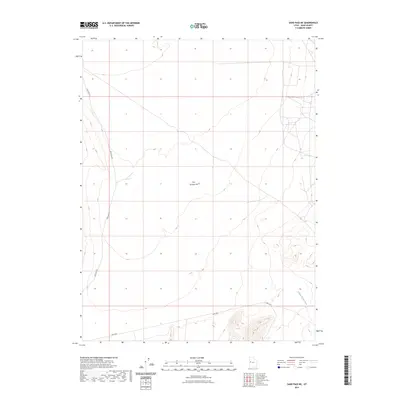
2023 Map of Sand Pass NE
USGS Topo · Published 2023About this map
Fish Springs Flat dominates this high-desert basin in Juab County, where the stark topography of western Utah is punctuated by the drainages of Swasey Knolls Wash. This 2023 survey illustrates the modern transportation corridor through this arid landscape, centered on the junction of Sand Pass Rd and Weis Hwy. The map provides a clear picture of the Basin and Range province's characteristic flat valley bottoms and the early stages of the rising foothills. For those researching the geography of the Great Salt Lake Desert's southern reaches, the detailed contour work reveals the subtle depressions and watercourse patterns that define this environment, showing how modern roadways still follow the natural contours of the land in one of the state's more isolated interior basins.
Find a feature on this map
4 named features on this map. Tap any name to fly to it.
Don’t see what you’re looking for? This feature index may not catch every label — zoom into the map to look around manually.
Map Details
Editions of this 2023 Sand Pass NE Map
This is the sole edition of this map. No revisions or reprints were ever made.
Other maps of this area

1908 · Fish Springs
USGS Topo · 1:250,000

1910 · Fish Springs
USGS Topo · 1:250,000

1953 · Dugway Range
USGS Topo · 1:62,500

1953 · Topaz Mtn
USGS Topo · 1:62,500

1953 · Delta
USGS Topo · 1:250,000

1958 · Delta
USGS Topo · 1:250,000

1962 · Delta
USGS Topo · 1:250,000

1967 · Sand Pass
USGS Topo · 1:24,000

1967 · Sand Pass NW
USGS Topo · 1:24,000

1967 · Sand Pass SE
USGS Topo · 1:24,000