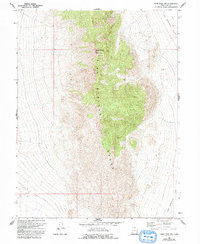
1967 Map of Sand Pass NW
USGS Topo · Published 1993About this map
George H Hansen Peak stands as the prominent high point within the central Fish Springs Range, a significant north-south topographical feature in this portion of Juab County. To the east, the terrain drops off into the expansive Fish Springs Flat, where the map indicates a few remote 4wd tracks navigating the desert basin. The 1967 field data captures a landscape defined by dramatic elevation changes, with the steep ridgeline of the range contrasting sharply with the surrounding valley floors. This survey reflects a period when the area remained primarily a wilderness of interest to geologists and those navigating the high desert, with minimal human development beyond the basic network of rugged trails used for land access and resource exploration.
Find a feature on this map
7 named features on this map. Tap any name to fly to it.
Don’t see what you’re looking for? This feature index may not catch every label — zoom into the map to look around manually.
Map Details
Editions of this 1967 Sand Pass NW Map
2 editions found
Other maps of this area

1908 · Fish Springs
USGS Topo · 1:250,000

1910 · Fish Springs
USGS Topo · 1:250,000

1953 · Delta
USGS Topo · 1:250,000

1958 · Delta
USGS Topo · 1:250,000

1960 · Granite Mountain
USGS Topo · 1:62,500

1962 · Delta
USGS Topo · 1:250,000

1967 · Sand Pass
USGS Topo · 1:24,000

1967 · Sand Pass NW
USGS Topo · 1:24,000

1967 · Sand Pass SE
USGS Topo · 1:24,000

1967 · Fish Springs SE
USGS Topo · 1:24,000