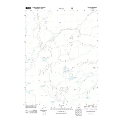
2011 Map of Sand Point
USGS Topo · Published 2011About this map
Pinnacle Peak and Sand Point anchor a landscape defined by an intricate network of high-altitude water management in Routt County. This 2011 survey illustrates the complex system of alpine ditches and reservoirs designed to move water across the Continental Divide's western slopes. Notable engineering features include the Allen Basin District Ditch and the Burnt Mesa Filler Ditch, which feed high-elevation catchments like Allen Basin Reservoir and Burnt Mesa Reservoir.
Find a feature on this map
53 named features on this map. Tap any name to fly to it.
Don’t see what you’re looking for? This feature index may not catch every label — zoom into the map to look around manually.
Map Details
Editions of this 2011 Sand Point Map
This is the sole edition of this map. No revisions or reprints were ever made.
Other maps of this area

1924 · Mt. Harris
USGS Topo · 1:48,000

1926 · Mount Harris
USGS Topo · 1:62,500

1954 · Craig
USGS Topo · 1:250,000

1957 · Craig
USGS Topo · 1:250,000

1958 · Craig
USGS Topo · 1:250,000

1960 · Craig
USGS Topo · 1:250,000

1962 · Craig
USGS Topo · 1:250,000

1964 · Craig
USGS Topo · 1:250,000

1965 · Craig
USGS Topo · 1:250,000
1966 · Dunckley Pass
USGS Topo · 1:24,000