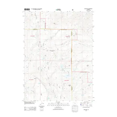
2013 Map of Sand Point
USGS Topo · Published 2013About this map
Routt National Forest dominates this high-altitude landscape along the border of Routt and Rio Blanco counties. The terrain is defined by prominent peaks including Pinnacle Peak, Heart Mountain, and Bellyache Mountain, with the flat-topped volcanic remains of Little Flat Tops rising to the south. Water management is a primary feature of the area, evidenced by a sophisticated network of high-country irrigation systems such as Last Chance Ditch, Mill Cr Ditch, and the Allen Basin District Ditch.
Find a feature on this map
53 named features on this map. Tap any name to fly to it.
Don’t see what you’re looking for? This feature index may not catch every label — zoom into the map to look around manually.
Map Details
Editions of this 2013 Sand Point Map
This is the sole edition of this map. No revisions or reprints were ever made.
Other maps of this area

1924 · Mt. Harris
USGS Topo · 1:48,000

1926 · Mount Harris
USGS Topo · 1:62,500

1954 · Craig
USGS Topo · 1:250,000

1957 · Craig
USGS Topo · 1:250,000

1958 · Craig
USGS Topo · 1:250,000

1960 · Craig
USGS Topo · 1:250,000

1962 · Craig
USGS Topo · 1:250,000

1964 · Craig
USGS Topo · 1:250,000

1965 · Craig
USGS Topo · 1:250,000
1966 · Dunckley Pass
USGS Topo · 1:24,000