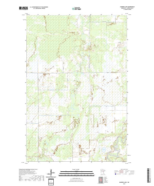
2022 Map of Sanders Lake
USGS Topo · Published 2022About this map
The Mississippi River winds through the southeastern corner of this Aitkin County landscape, where it meets the southern reaches of the Willow River. This area is defined by its extensive wetlands and complex drainage patterns, with the Willow River meandering extensively through the central portion of the quadrangle before its confluence. Near the river's bend, the Mississippi River Trl provides a designated path through the low-lying terrain, connecting to local routes like Co Hwy 10. The presence of Sanders Lake near the township line of t49n r24w highlights the glacial topography typical of this part of Minnesota. Settlement is sparse, characterized by a grid of rural roads such as Co Rd 18 and N Willow Rd that navigate the marshy ground, offering a look at the modern land use and conservation patterns in this riverine environment.
Find a feature on this map
25 named features on this map. Tap any name to fly to it.
Don’t see what you’re looking for? This feature index may not catch every label — zoom into the map to look around manually.
Map Details
Editions of this 2022 Sanders Lake Map
This is the sole edition of this map. No revisions or reprints were ever made.
Other maps of this area

1914 · Aitkin
USGS Topo · 1:62,500

1915 · Aitkin
USGS Topo · 1:62,500

1953 · Duluth
USGS Topo · 1:250,000

1958 · Duluth
USGS Topo · 1:250,000

1970 · Rabey
USGS Topo · 1:24,000

1970 · Palisade
USGS Topo · 1:24,000

1970 · Sanders Lake
USGS Topo · 1:24,000
1970 · Ball Bluff
USGS Topo · 1:24,000

1970 · Libby
USGS Topo · 1:24,000
1970 · Minnewawa
USGS Topo · 1:24,000