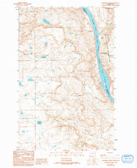
1989 Map of Sanderson Creek
USGS Topo · Published 1994About this map
Columbia River - Rufus Woods Lake serves as a defining boundary in this high-plateau region, separating Okanogan and Douglas counties. The eastern bank is occupied by the Colville Indian Reservation, where the landscape is marked by steep breaks like Kaiser Canyon and Bailey Basin. On the western plateau, the drainage pattern is characterized by several small terminal basins and seasonal water bodies, including Black Lake, Rock Lake, and Smith Lake.
Find a feature on this map
15 named features on this map. Tap any name to fly to it.
Don’t see what you’re looking for? This feature index may not catch every label — zoom into the map to look around manually.
Map Details
Editions of this 1989 Sanderson Creek Map
2 editions found
Other maps of this area

1948 · Grand Coulee Dam
USGS Topo · 1:62,500

1950 · Grand Coulee Dam
USGS Topo · 1:62,500

1950 · Nespelem
USGS Topo · 1:62,500

1950 · Alameda Flat
USGS Topo · 1:62,500

1952 · Alameda Flat
USGS Topo · 1:62,500

1953 · Ritzville
USGS Topo · 1:250,000

1954 · Okanogan
USGS Topo · 1:250,000

1958 · Okanogan
USGS Topo · 1:250,000

1959 · Ritzville
USGS Topo · 1:250,000

1965 · Ritzville
USGS Topo · 1:250,000