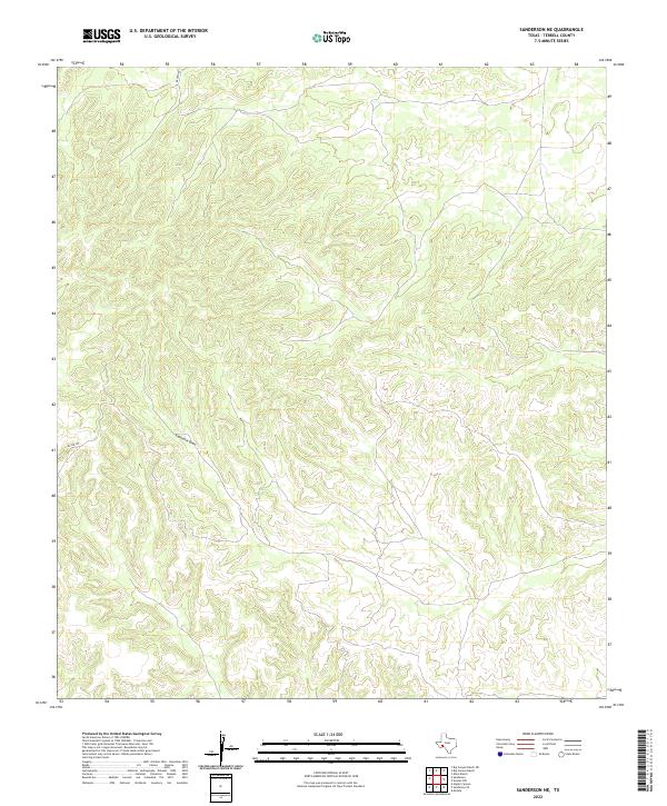
2022 Map of Sanderson NE
USGS Topo · Published 2022About this map
Eightmile Draw carves a deep path across this high desert landscape in eastern Terrell County, representing the primary drainage system for the surrounding plateau. The terrain is characterized by intricate contour lines that reveal a complex network of ridges and canyons typical of the Trans-Pecos region. Limited human intervention is visible in this part of West Texas, with transportation restricted to primitive routes like Brown Rd in the north and McCue Rd in the west. These roads likely serve remote ranching operations, tracing the easiest paths through the broken limestone topography. The absence of permanent settlements or industrial infrastructure underscores the isolation of this corner of the state, where the natural water drainage patterns remain the most prominent features on the land.
Find a feature on this map
3 named features on this map. Tap any name to fly to it.
Don’t see what you’re looking for? This feature index may not catch every label — zoom into the map to look around manually.
Map Details
Editions of this 2022 Sanderson NE Map
This is the sole edition of this map. No revisions or reprints were ever made.
Other maps of this area

1928 · Sanderson
USGS Topo · 1:125,000

1954 · Fort Stockton
USGS Topo · 1:250,000

1958 · Fort Stockton
USGS Topo · 1:250,000

1969 · Sanderson SE
USGS Topo · 1:24,000

1969 · Sanderson
USGS Topo · 1:24,000

1969 · Big Canyon Ranch
USGS Topo · 1:24,000

1969 · Mofeta
USGS Topo · 1:24,000
1969 · Big Canyon Ranch SW
USGS Topo · 1:24,000
1969 · Hagler Canyon
USGS Topo · 1:24,000

1969 · Dryden NW
USGS Topo · 1:24,000