
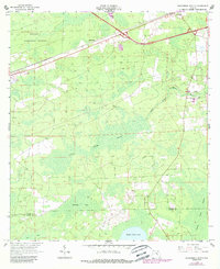
1963 Map of Sanderson South
USGS Topo · Published 1964About this map
Osceola National Forest dominates the northwestern portion of this Baker County landscape, where the Seaboard Air Line railroad and US Highway 90 cut through the timbered terrain. The settlement of Sanderson serves as a local hub near the northern edge, while the rural community of Bethlehem is anchored by the Bethlehem Ch and its adjacent Bethlehem Cem further east.
Find a feature on this map
21 named features on this map. Tap any name to fly to it.
Don’t see what you’re looking for? This feature index may not catch every label — zoom into the map to look around manually.
Map Details
Editions of this 1963 Sanderson South Map
2 editions found
Other maps of this area

1917 · Macclenny
USGS Topo · 1:62,500

1918 · Lawtey
USGS Topo · 1:62,500

1918 · Macclenny
USGS Topo · 1:62,500

1954 · Valdosta
USGS Topo · 1:250,000

1958 · Valdosta
USGS Topo · 1:250,000

1959 · Valdosta
USGS Topo · 1:250,000

1963 · Olustee
USGS Topo · 1:24,000

1966 · Lake Butler
USGS Topo · 1:24,000
1966 · Lulu
USGS Topo · 1:24,000

1969 · Sanderson North
USGS Topo · 1:24,000