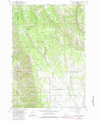
1963 Map of Sanderson Spring
USGS Topo · Published 1984About this map
The high timber and remote canyons of the Umatilla National Forest dominate this 1963 survey of the northern Grande Ronde Valley. This is a landscape shaped by seasonal ranching and forestry, evidenced by the presence of Stanley Cabin, Craigs Cabin, and the Finley Creek Cow Camp. Steep ridgelines like Finley Ridge and Pfefferkorn Ridge define the drainage patterns where Dry Ruckel Creek and Phillips Creek carve through the terrain. In the lower elevations, the transition to the valley floor is marked by Little Valley and the Woddell-Gresham area. The importance of reliable water sources in this high country is highlighted by the identification of Sanderson Spring and McMullen Spring, while various jeep trails and the Skyline Road provide the primary access through the dense woodland of the Blue Mountains.
Find a feature on this map
42 named features on this map. Tap any name to fly to it.
Don’t see what you’re looking for? This feature index may not catch every label — zoom into the map to look around manually.
Map Details
Editions of this 1963 Sanderson Spring Map
2 editions found
Other maps of this area

1906 · Telocaset
USGS Topo · 1:125,000

1953 · Pendleton
USGS Topo · 1:250,000

1955 · Grangeville
USGS Topo · 1:250,000

1956 · Pendleton
USGS Topo · 1:250,000

1959 · Grangeville
USGS Topo · 1:250,000

1963 · Andies Prairie
USGS Topo · 1:24,000

1963 · Sanderson Spring
USGS Topo · 1:24,000

1963 · Bingham Springs
USGS Topo · 1:24,000

1963 · Summerville
USGS Topo · 1:24,000

1964 · Partridge Creek
USGS Topo · 1:24,000