
1952 Map of Sands
USGS Topo · Published 1954About this map
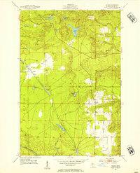
The Chicago and North Western railway anchors this early 1950s study of Marquette County, cutting a path through the diverse terrain of the Sands and Richmond townships. Small settlements like Sands Station, Gentian, and Cascade appear alongside the rail line, indicating a landscape where transportation and light industry, such as the Gravel Pits near Little Pelesier Lake, defined local commerce. To the north and west, the elevation rises into the Kona Hills and Range Hills, while the southern reaches are drained by the East Branch Escanaba River. The intricate network of water bodies, including Powell Lake, Strawberry Lake, and Uncle Tom Lake, suggests a geography dominated by glacial remains and wetlands. This survey provides a precise look at the transition from the high bluffs of Migisy Bluff to the creek-fed lowlands of Silver Creek and Cedar Creek before significant modern development altered the Upper Peninsula interior.
Find a feature on this map
31 named features on this map. Tap any name to fly to it.
Don’t see what you’re looking for? This feature index may not catch every label — zoom into the map to look around manually.
Map Details
Editions of this 1952 Sands Map
4 editions found
Other maps of this area

1907 · Marquette
USGS Topo · 1:62,500

1932 · Harvey NW
USGS Topo · 1:31,680

1932 · Harvey SE
USGS Topo · 1:31,680

1932 · Harvey SW
USGS Topo · 1:31,680

1932 · Harvey NE
USGS Topo · 1:31,680

1952 · Ishpeming
USGS Topo · 1:62,500

1952 · Gwinn
USGS Topo · 1:62,500

1952 · Palmer
USGS Topo · 1:24,000

1952 · Gwinn
USGS Topo · 1:24,000

1953 · Negaunee
USGS Topo · 1:24,000
Featured Places
- Sands, Sands Township
- Negaunee Township, MI
- Marquette Township, MI
- Crossroads, Sands Township
- Cascade, Sands Township