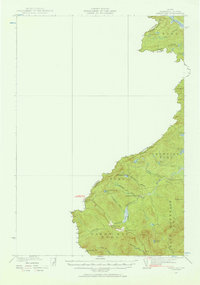
1927 Map of Sandy Bay
USGS Topo · Published 1957About this map
The Canada United States border defines this 1927 survey of the northern Maine woods, where the remote townships of Sandy Bay and Prentiss meet the Quebec line. The landscape is a network of timberlands and high-elevation waters, draining through the South Branch Penobscot River and the winding West Br Sandy Stream. Isolated outposts like Hilton Farm, Sandy Bay Farm, and South Branch Camp provide rare evidence of human habitation in a region dominated by peaks such as Bald Mountain and Sandy Bay Mtn.
Find a feature on this map
38 named features on this map. Tap any name to fly to it.
Don’t see what you’re looking for? This feature index may not catch every label — zoom into the map to look around manually.
Map Details
Editions of this 1927 Sandy Bay Map
5 editions found
Other maps of this area

1922 · Long Pond
USGS Topo · 1:62,500

1923 · Attean
USGS Topo · 1:62,500

1924 · Long Pond
USGS Topo · 1:62,500

1925 · Attean
USGS Topo · 1:62,500

1927 · Sandy Bay
USGS Topo · 1:48,000

1928 · Skinner
USGS Topo · 1:48,000

1930 · Sandy Bay
USGS Topo · 1:62,500

1931 · Skinner
USGS Topo · 1:62,500

1944 · Long Pond
USGS Topo · 1:62,500

1944 · Sandy Bay
USGS Topo · 1:62,500