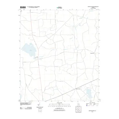
2011 Map of Sandy Bottom
USGS Topo · Published 2011About this map
Guest Millpond and its associated Guest Millpond Dam serve as a central geographic anchor in this Atkinson County landscape, where various watercourses including Red Bluff Creek and Stump Creek drain the low-lying terrain. The map documents a rural transition in the early 21st century, defined by a network of named country roads and significant timber-related infrastructure such as Timber Products.
Find a feature on this map
29 named features on this map. Tap any name to fly to it.
Don’t see what you’re looking for? This feature index may not catch every label — zoom into the map to look around manually.
Map Details
Editions of this 2011 Sandy Bottom Map
This is the sole edition of this map. No revisions or reprints were ever made.
Other maps of this area

1953 · Waycross
USGS Topo · 1:250,000

1958 · Waycross
USGS Topo · 1:250,000

1968 · Homerville East
USGS Topo · 1:24,000

1968 · Cogdell
USGS Topo · 1:24,000

1971 · Axson
USGS Topo · 1:24,000

1971 · Pearson
USGS Topo · 1:24,000

1972 · Kirkland
USGS Topo · 1:24,000

1972 · Sirmans
USGS Topo · 1:24,000

1972 · Sandy Bottom
USGS Topo · 1:24,000

1972 · Henderson Still
USGS Topo · 1:24,000