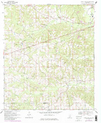
1970 Map of Sandy Hook NW
USGS Topo · Published 1982About this map
The Marion and Walthall County line bisects this corner of south-central Mississippi during a period of steady industrial transition. The landscape is defined by the drainage basins of Silver Creek, Indian Creek, and Tenmile Creek, where the timber and agricultural roots of the region meet the infrastructure of the energy and aggregate industries. Evidence of this shift is seen in the numerous Gravel Pits and Gas Wells dotting the hills, alongside major transit corridors like the Illinois Central Gulf railroad.
Find a feature on this map
32 named features on this map. Tap any name to fly to it.
Don’t see what you’re looking for? This feature index may not catch every label — zoom into the map to look around manually.
Map Details
Editions of this 1970 Sandy Hook NW Map
3 editions found
Other maps of this area

1953 · Hattiesburg
USGS Topo · 1:250,000

1953 · Natchez
USGS Topo · 1:250,000

1956 · Natchez
USGS Topo · 1:250,000

1958 · Hattiesburg
USGS Topo · 1:250,000

1959 · Natchez
USGS Topo · 1:250,000

1970 · Columbia South
USGS Topo · 1:24,000

1970 · Sandy Hook NW
USGS Topo · 1:24,000
1970 · Tylertown SE
USGS Topo · 1:24,000

1970 · Kokomo
USGS Topo · 1:24,000

1970 · Darbun
USGS Topo · 1:24,000