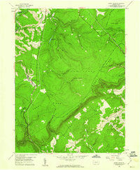
1958 Map of Sandy Ridge
USGS Topo · Published 1960About this map
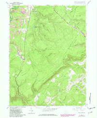
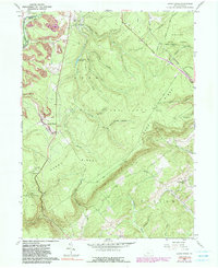
Moshannon State Forest dominates this Central Pennsylvania landscape, where the ridges of the Allegheny Front meet industrial activity in the late 1950s. The village of Sandy Ridge serves as a focal point along the Pennsylvania railroad line, while the nearby settlement of Glass City sits just south of the Moshannon Creek headwaters. The topography is defined by significant elevations like Sandy Ridge and Rush Ridge, cut by numerous watercourses including Cold Stream and Black Bear Run. Industrial presence is evident through several Strip Mines operating in the northwest, contrasting with the conservation lands of State Game Lands No 33 and State Game Lands No 60. For genealogists, the map preserves the location of the Mt Pleasant Ch and Mt Pleasant Cem in the southeast corner near Fowler Hollow.
Find a feature on this map
41 named features on this map. Tap any name to fly to it.
Don’t see what you’re looking for? This feature index may not catch every label — zoom into the map to look around manually.
Map Details
Editions of this 1958 Sandy Ridge Map
6 editions found
Other maps of this area

1903 · Houtzdale
USGS Topo · 1:62,500

1905 · Houtzdale
USGS Topo · 1:62,500

1920 · Altoona
USGS Topo · 1:62,500

1922 · Philipsburg
USGS Topo · 1:62,500

1922 · Altoona
USGS Topo · 1:62,500

1923 · Tyrone
USGS Topo · 1:62,500

1929 · Tyrone
USGS Topo · 1:48,000

1933 · Tyrone
USGS Topo · 1:62,500

1939 · Philipsburg
USGS Topo · 1:62,500

1944 · Houtzdale
USGS Topo · 1:24,000