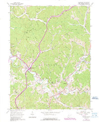
1960 Map of Sandyville
USGS Topo · Published 1989About this map
Sandyville serves as a central hub in this corner of Jackson County, where the winding course of Little Sandy Creek and the Left Fork define the valley floors. The landscape is marked by a dense network of family cemeteries, such as Nesselroad Cem and Springston Cem, which reflect the generations of settlement along the numerous runs and hollows. Small communities like Odaville and Silverton are situated along the primary routes, with Silverton notably serving as a junction for Interchange 146.
Find a feature on this map
88 named features on this map. Tap any name to fly to it.
Don’t see what you’re looking for? This feature index may not catch every label — zoom into the map to look around manually.
Map Details
Editions of this 1960 Sandyville Map
3 editions found
Other maps of this area

1906 · Belleville
USGS Topo · 1:62,500

1907 · Keno
USGS Topo · 1:62,500

1907 · Ripley
USGS Topo · 1:62,500

1908 · Ravenswood
USGS Topo · 1:62,500

1924 · Belleville
USGS Topo · 1:62,500

1926 · Ravenswood
USGS Topo · 1:62,500

1926 · Belleville
USGS Topo · 1:62,500

1926 · Ripley
USGS Topo · 1:62,500

1928 · Ravenswood
USGS Topo · 1:62,500

1928 · Ripley
USGS Topo · 1:62,500