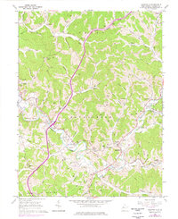
1960 Map of Sandyville
USGS Topo · Published 1977About this map
Sandy Creek and the Baltimore and Ohio Railroad anchor this Jackson County landscape, where winding valleys support a network of rural settlements and family-named landmarks. The terrain is characterized by numerous runs and forks, including Meathouse Fork and Left Fork Sandy Creek, which historically dictated the placement of roads and homesteads. Local life in the mid-20th century is evidenced by a concentration of community institutions such as McGees Chapel, Gilmore High Sch, and several family cemeteries like Derenburger Cem and Nesselroad Cem.
Find a feature on this map
84 named features on this map. Tap any name to fly to it.
Don’t see what you’re looking for? This feature index may not catch every label — zoom into the map to look around manually.
Map Details
Editions of this 1960 Sandyville Map
3 editions found
Other maps of this area

1906 · Belleville
USGS Topo · 1:62,500

1907 · Keno
USGS Topo · 1:62,500

1907 · Ripley
USGS Topo · 1:62,500

1908 · Ravenswood
USGS Topo · 1:62,500

1924 · Belleville
USGS Topo · 1:62,500

1926 · Ravenswood
USGS Topo · 1:62,500

1926 · Belleville
USGS Topo · 1:62,500

1926 · Ripley
USGS Topo · 1:62,500

1928 · Ravenswood
USGS Topo · 1:62,500

1928 · Ripley
USGS Topo · 1:62,500