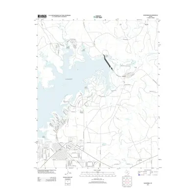
2012 Map of Sanford
USGS Topo · Published 2012About this map
Lake Meredith dominates the landscape of this Hutchinson County region, where the impounded waters of the Canadian River reach into several deep-cut drainages including Bugbee Canyon and Cedar Canyon. The town of Sanford sits near the dam's southeastern edge, established within a network of ranch and oil-field roads like Sanford Yake Rd. Further southwest, the growing street grid of Fritch extends toward the water's edge at Fritch Canyon, supporting the recreational activity centered around the Lake Meredith Natl Rec Area. Industrial footprints are visible at the Sanford Yake Oil Field, while local history is anchored at the Sanford Cem and Westlawn Memorial Park. The terrain is characterized by high plains dissected by the wide, sandy beds of Antelope Cr and Camp Cr.
Find a feature on this map
119 named features on this map. Tap any name to fly to it.
Don’t see what you’re looking for? This feature index may not catch every label — zoom into the map to look around manually.
Map Details
Editions of this 2012 Sanford Map
This is the sole edition of this map. No revisions or reprints were ever made.
Other maps of this area

1939 · Sanford
USGS Topo · 1:62,500

1953 · Sanford
USGS Topo · 1:24,000

1953 · Alibates Ranch
USGS Topo · 1:24,000

1953 · Stinnett
USGS Topo · 1:24,000

1953 · Evans Canyon
USGS Topo · 1:24,000

1953 · Deal
USGS Topo · 1:24,000

1953 · McBride
USGS Topo · 1:24,000

1953 · Borger
USGS Topo · 1:24,000

1954 · Amarillo
USGS Topo · 1:250,000

1958 · Amarillo
USGS Topo · 1:250,000