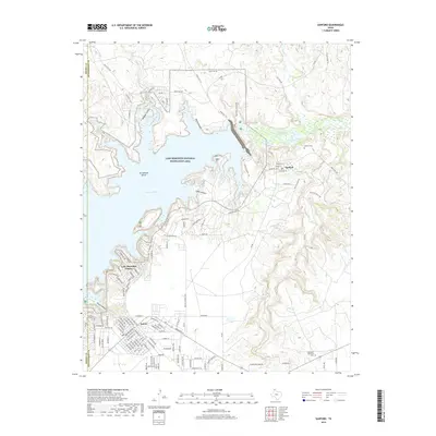
2019 Map of Sanford
USGS Topo · Published 2019About this map
The Lake Meredith National Recreation Area dominates this Panhandle landscape, where the waters of the Canadian River are impounded to form the reservoir. The topography is defined by significant drainage systems, including Bugbee Canyon, North Canyon, and Cedar Canyon, which carve through the plains toward the water. Human settlement is concentrated in the communities of Fritch and Sanford, with residential development extending to Lake Meredith Estates along the western shoreline.
Find a feature on this map
128 named features on this map. Tap any name to fly to it.
Don’t see what you’re looking for? This feature index may not catch every label — zoom into the map to look around manually.
Map Details
Editions of this 2019 Sanford Map
This is the sole edition of this map. No revisions or reprints were ever made.
Other maps of this area

1939 · Sanford
USGS Topo · 1:62,500

1953 · Sanford
USGS Topo · 1:24,000

1953 · Alibates Ranch
USGS Topo · 1:24,000

1953 · Stinnett
USGS Topo · 1:24,000

1953 · Evans Canyon
USGS Topo · 1:24,000

1953 · Deal
USGS Topo · 1:24,000

1953 · McBride
USGS Topo · 1:24,000

1953 · Borger
USGS Topo · 1:24,000

1954 · Amarillo
USGS Topo · 1:250,000

1958 · Amarillo
USGS Topo · 1:250,000