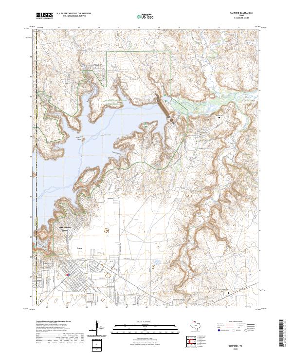
2023 Map of Sanford
USGS Topo · Published 2023About this map
The Canadian River and its massive impoundment at Lake Meredith dominate this Texas Panhandle landscape on the border of Moore and Hutchinson counties. Modern settlements such as Sanford and Fritch are situated along the high ground overlooking the reservoir's deeply incised canyons. Much of the northern portion of the sheet is dedicated to the Lake Meredith National Recreation Area, where rugged features like Bugbee Canyon and Cedar Canyon meet the water’s edge. The residential development of Lake Meredith Estates and the presence of Sanford Cem provide clear reference points for local history and genealogy research. The terrain is marked by numerous seasonal drainages, including Antelope Creek and Camp Creek, which feed into the primary river system. This survey illustrates the contemporary balance between recreational land use and the residential expansion of the High Plains.
Find a feature on this map
130 named features on this map. Tap any name to fly to it.
Don’t see what you’re looking for? This feature index may not catch every label — zoom into the map to look around manually.
Map Details
Editions of this 2023 Sanford Map
This is the sole edition of this map. No revisions or reprints were ever made.
Other maps of this area

1939 · Sanford
USGS Topo · 1:62,500

1953 · Sanford
USGS Topo · 1:24,000

1953 · Alibates Ranch
USGS Topo · 1:24,000

1953 · Stinnett
USGS Topo · 1:24,000

1953 · Evans Canyon
USGS Topo · 1:24,000

1953 · Deal
USGS Topo · 1:24,000

1953 · McBride
USGS Topo · 1:24,000

1953 · Borger
USGS Topo · 1:24,000

1954 · Amarillo
USGS Topo · 1:250,000

1958 · Amarillo
USGS Topo · 1:250,000