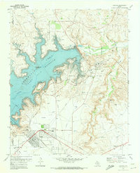
1970 Map of Sanford
USGS Topo · Published 1973About this map
Lake Meredith Recreation Area dominates this Panhandle landscape, created by the massive Sanford Dam on the Canadian River. The map captures the region during a period of transition as it balanced recreational development with its established petroleum economy. Extensive infrastructure for the Sanford Yake Oil Field is visible throughout the terrain, featuring a dense network of pipelines, gas wells, and a Gasoline Plant near Sanford. To the south, the town of Fritch shows a structured street grid and local amenities including a High Sch and athletic field. The Chicago Rock Island and Pacific railroad cuts through the eastern canyons, providing a vital industrial link. Family history researchers will find the Sanford Cem and Westlawn Mem Park (Cem) clearly marked, while shoreline features like Arrowhead Island and the Fritch Fortress Picnic Area illustrate the area's emerging role as a regional destination.
Find a feature on this map
29 named features on this map. Tap any name to fly to it.
Don’t see what you’re looking for? This feature index may not catch every label — zoom into the map to look around manually.
Map Details
Editions of this 1970 Sanford Map
This is the sole edition of this map. No revisions or reprints were ever made.
Other maps of this area

1939 · Sanford
USGS Topo · 1:62,500

1953 · Sanford
USGS Topo · 1:24,000

1953 · Alibates Ranch
USGS Topo · 1:24,000

1953 · Stinnett
USGS Topo · 1:24,000

1953 · Evans Canyon
USGS Topo · 1:24,000

1953 · Deal
USGS Topo · 1:24,000

1953 · McBride
USGS Topo · 1:24,000

1953 · Borger
USGS Topo · 1:24,000

1954 · Amarillo
USGS Topo · 1:250,000

1958 · Amarillo
USGS Topo · 1:250,000