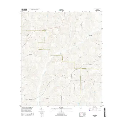
2014 Map of Sanford
USGS Topo · Published 2014About this map
Sanford serves as a central point in this rural landscape where Stewart, Quitman, and Randolph counties converge. The terrain is defined by an intricate network of waterways, including Hodchodkee Cr and its many tributaries like Wolf Cr and Arkansas Cr. This network historically influenced the placement of local crossings, such as Ray Bridge and Lawson Bridge. Small communities like Union and Sugar Hill anchor the southern portion of the map, connected by a web of local roads including Lower Lumpkin Rd and Union Church Rd.
Find a feature on this map
50 named features on this map. Tap any name to fly to it.
Don’t see what you’re looking for? This feature index may not catch every label — zoom into the map to look around manually.
Map Details
Editions of this 2014 Sanford Map
This is the sole edition of this map. No revisions or reprints were ever made.
Other maps of this area

1950 · Lumpkin
USGS Topo · 1:24,000

1950 · Lumpkin SW
USGS Topo · 1:24,000

1950 · Lumpkin
USGS Topo · 1:62,500

1953 · Dothan
USGS Topo · 1:250,000

1954 · Dothan
USGS Topo · 1:250,000

1955 · Dothan
USGS Topo · 1:250,000

1955 · Lumpkin
USGS Topo · 1:24,000

1955 · Lumpkin SW
USGS Topo · 1:24,000

1955 · Lumpkin
USGS Topo · 1:62,500

1955 · Phenix City
USGS Topo · 1:250,000