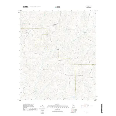
2020 Map of Sanford
USGS Topo · Published 2020About this map
Sanford serves as a central point in this rural landscape at the intersection of three Georgia counties: Stewart, Quitman, and Randolph. The terrain is defined by an intricate network of waterways, most notably the Hodechodkee Cr and its tributaries like Bozeman Mill Br, which carve through the wooded hills. These watercourses are crossed by local landmarks such as Ray Bridge and Lawson Bridge. Small agricultural communities and family settlements like Sugar Hill and Union are connected by a web of county roads, including Bethel Church Rd and Sharon Church Rd. Genealogists will find several burial grounds of interest, including Hogan Cem and the County Line Church Cem, which help anchor the family histories of this tri-county border region.
Find a feature on this map
58 named features on this map. Tap any name to fly to it.
Don’t see what you’re looking for? This feature index may not catch every label — zoom into the map to look around manually.
Map Details
Editions of this 2020 Sanford Map
This is the sole edition of this map. No revisions or reprints were ever made.
Other maps of this area

1950 · Lumpkin
USGS Topo · 1:24,000

1950 · Lumpkin SW
USGS Topo · 1:24,000

1950 · Lumpkin
USGS Topo · 1:62,500

1953 · Dothan
USGS Topo · 1:250,000

1954 · Dothan
USGS Topo · 1:250,000

1955 · Dothan
USGS Topo · 1:250,000

1955 · Lumpkin
USGS Topo · 1:24,000

1955 · Lumpkin SW
USGS Topo · 1:24,000

1955 · Lumpkin
USGS Topo · 1:62,500

1955 · Phenix City
USGS Topo · 1:250,000