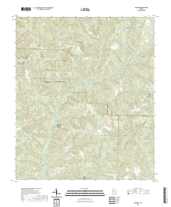
2024 Map of Sanford
USGS Topo · Published 2024About this map
Sanford and Sugar Hill anchor this rural landscape where the borders of Stewart, Quitman, and Randolph counties converge. The terrain is defined by an intricate network of watercourses, including Hodchodkee Creek and Arkansas Creek, which carve through the countryside alongside smaller tributaries like Foreman Mill Branch and Bladen Creek. This modern survey reveals a persistent pattern of rural life, with community hubs centered around longtime institutions such as Elam Baptist Church and the dual cemeteries of Union Methodist Church Cem West and Union Methodist Church Cem East in the settlement of Union. Genealogists will find particular value in the identification of family-named landmarks such as Hogan Family Cem and the Davis Chapel African Methodist Episcopal Church, documenting the cultural and family heritage of this corner of southwest Georgia.
Find a feature on this map
61 named features on this map. Tap any name to fly to it.
Don’t see what you’re looking for? This feature index may not catch every label — zoom into the map to look around manually.
Map Details
Editions of this 2024 Sanford Map
This is the sole edition of this map. No revisions or reprints were ever made.
Other maps of this area

1950 · Lumpkin
USGS Topo · 1:24,000

1950 · Lumpkin SW
USGS Topo · 1:24,000

1950 · Lumpkin
USGS Topo · 1:62,500

1953 · Dothan
USGS Topo · 1:250,000

1954 · Dothan
USGS Topo · 1:250,000

1955 · Dothan
USGS Topo · 1:250,000

1955 · Lumpkin
USGS Topo · 1:24,000

1955 · Lumpkin SW
USGS Topo · 1:24,000

1955 · Lumpkin
USGS Topo · 1:62,500

1955 · Phenix City
USGS Topo · 1:250,000