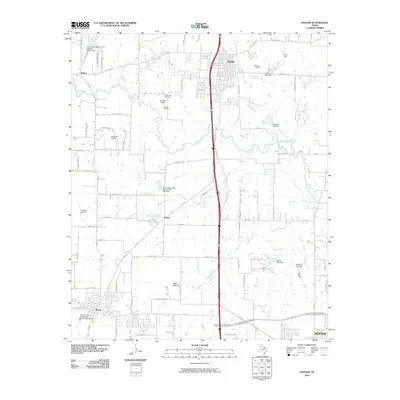
2010 Map of Sanger
USGS Topo · Published 2010About this map
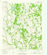
Sanger and its surrounding agricultural and energy-producing lands are captured here at a moment of significant northern Denton County growth. The landscape is defined by the corridor of the Stemmans Fwy and the older routes of FM 156 and Railroad Ave. Outside the primary settlements of Krum and Bolivar, the area is punctuated by small private airfields such as Flying V Airport, Ironhead Airport, and Richards Airport, reflecting a pattern of rural land use where aviation and ranching intersect. Genealogists will find the Sanger Cemetery and Duck Creek Cemetery clearly marked among the drainages of Clear Creek and Duck Creek. The presence of the Sanger Oil Field near the center of the quadrangle indicates the area's continued industrial activity, while numerous small water impoundments like Lane Lake Dam and Tedrow Lake Dam highlight the importance of water management in this prairie terrain.
Find a feature on this map
71 named features on this map. Tap any name to fly to it.
Don’t see what you’re looking for? This feature index may not catch every label — zoom into the map to look around manually.
Map Details
Editions of this 2010 Sanger Map
This is the sole edition of this map. No revisions or reprints were ever made.
Other maps of this area

1954 · Sherman
USGS Topo · 1:250,000

1958 · Sherman
USGS Topo · 1:250,000

1959 · Ponder
USGS Topo · 1:24,000

1960 · Sanger
USGS Topo · 1:24,000

1960 · Green Valley
USGS Topo · 1:24,000
1960 · Denton East
USGS Topo · 1:24,000
1960 · Denton West
USGS Topo · 1:24,000

1961 · Era
USGS Topo · 1:24,000
1961 · Era SE
USGS Topo · 1:24,000
1961 · Mountain Springs
USGS Topo · 1:24,000