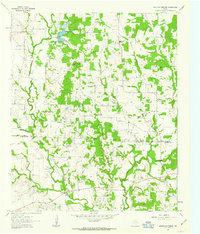
1961 Map of Mountain Springs
USGS Topo · Published 1963About this map
Mountain Springs and the surrounding North Texas countryside are defined by the winding course of the Elm Fork Trinity River and its numerous tributaries. In the early 1960s, this landscape straddling the boundary of Cooke and Denton counties was a mix of agriculture and burgeoning energy extraction. The presence of the Jacobs Oil Field and scattered oil wells north of Bois du Arc Creek illustrates the industrial footprint of the era. Settlement patterns are largely rural, anchored by small communities like Bloomfield and Hemming.
Find a feature on this map
28 named features on this map. Tap any name to fly to it.
Don’t see what you’re looking for? This feature index may not catch every label — zoom into the map to look around manually.
Map Details
Editions of this 1961 Mountain Springs Map
Other maps of this area

1901 · Denison
USGS Topo · 1:125,000

1902 · Gainesville
USGS Topo · 1:125,000

1943 · Gainesville
USGS Topo · 1:125,000

1954 · Sherman
USGS Topo · 1:250,000

1958 · Whitesboro
USGS Topo · 1:62,500

1958 · Sherman
USGS Topo · 1:250,000

1960 · Sanger
USGS Topo · 1:24,000

1960 · Green Valley
USGS Topo · 1:24,000

1960 · Aubrey
USGS Topo · 1:24,000

1960 · Gainesville South
USGS Topo · 1:24,000