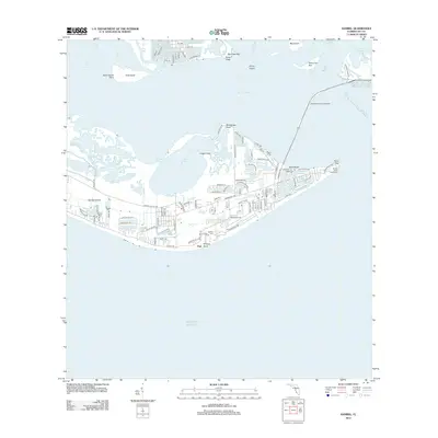
2012 Map of Sanibel
USGS Topo · Published 2012About this map
Sanibel Island sits at the convergence of the Gulf of Mexico, Pine Island Sound, and San Carlos Bay in this 2012 topographic survey. The landscape is defined by its intricate shoreline, where features like Shallow Mouth and Shallow Cutoff illustrate the tidal dynamics of the Florida coast. At the eastern tip, Point Ybel serves as a critical navigation landmark, home to the Sanibel Island Lighthouse.
Find a feature on this map
97 named features on this map. Tap any name to fly to it.
Don’t see what you’re looking for? This feature index may not catch every label — zoom into the map to look around manually.
Map Details
Editions of this 2012 Sanibel Map
This is the sole edition of this map. No revisions or reprints were ever made.
Other maps of this area

1956 · West Palm Beach
USGS Topo · 1:250,000

1956 · Tampa
USGS Topo · 1:250,000

1956 · Charlotte Harbor
USGS Topo · 1:250,000

1957 · West Palm Beach
USGS Topo · 1:250,000

1958 · West Palm Beach
USGS Topo · 1:250,000

1958 · Captiva
USGS Topo · 1:24,000

1958 · Fort Myers SW
USGS Topo · 1:24,000

1958 · Sanibel
USGS Topo · 1:24,000

1958 · Pine Island Center
USGS Topo · 1:24,000
1958 · Wulfert
USGS Topo · 1:24,000
Featured Places
- Sanibel, FL
- Saint James Mobile Home Park, FL
- Ybel, Sanibel
- Punta Rassa Condos, Punta Rassa
- Saint James City, FL