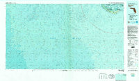
1981 Map of Sanibel
USGS Topo · Published 1982About this map
Sanibel Island serves as the focal point of this 1981 topographic-bathymetric study, illustrating the delicate balance between human settlement and extensive conservation lands at the mouth of San Carlos Bay. The map highlights the sprawling reaches of the J. N. "Ding" Darling National Wildlife Refuge and the Sanibel Island State Botanical Site, which dominate the island's interior. This era reflects a period of established environmental protection, with the Pine Island Sound Aquatic Preserve and Matlacha Pass National Wildlife Refuge buffering the coastal reaches. Beyond the immediate settlement of Sanibel and its iconic southern Lighthouse, the map provides detailed bathymetric contours for the Gulf of Mexico, including offshore protraction survey data used for resource management. The geography emphasizes the island's isolation and its role as a sanctuary, separated from the mainland by a network of sounds and passes.
Find a feature on this map
13 named features on this map. Tap any name to fly to it.
Don’t see what you’re looking for? This feature index may not catch every label — zoom into the map to look around manually.
Map Details
Editions of this 1981 Sanibel Map
2 editions found
Other maps of this area

1956 · Miami
USGS Topo · 1:250,000

1956 · West Palm Beach
USGS Topo · 1:250,000

1956 · Tampa
USGS Topo · 1:250,000

1956 · Charlotte Harbor
USGS Topo · 1:250,000

1957 · West Palm Beach
USGS Topo · 1:250,000

1958 · West Palm Beach
USGS Topo · 1:250,000

1958 · Miami
USGS Topo · 1:250,000

1958 · Captiva
USGS Topo · 1:24,000

1958 · Fort Myers SW
USGS Topo · 1:24,000

1958 · Sanibel
USGS Topo · 1:24,000