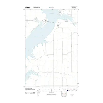
2011 Map of Sanish
USGS Topo · Published 2011About this map
Lake Sakakawea dominates this 2011 survey, illustrating the complex geography where the Missouri River flows into the vast reservoir on the Fort Berthold Indian Reservation. The settlement of Four Bears Village sits prominently on the western shore, connected to the mainland via the Four Bears Memorial Bridge. This infrastructure is central to the area's modern identity, providing a vital link across the water.
Find a feature on this map
22 named features on this map. Tap any name to fly to it.
Don’t see what you’re looking for? This feature index may not catch every label — zoom into the map to look around manually.
Map Details
Editions of this 2011 Sanish Map
This is the sole edition of this map. No revisions or reprints were ever made.
Other maps of this area

1953 · Williston
USGS Topo · 1:250,000

1953 · Watford City
USGS Topo · 1:250,000

1957 · Williston
USGS Topo · 1:250,000

1957 · Watford City
USGS Topo · 1:250,000

1967 · Watford City
USGS Topo · 1:250,000

1967 · Sanish NW
USGS Topo · 1:24,000

1967 · Sanish
USGS Topo · 1:24,000

1967 · Sanish SE
USGS Topo · 1:24,000

1967 · New Town SW
USGS Topo · 1:24,000

1967 · Sanish SW
USGS Topo · 1:24,000