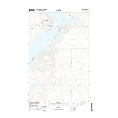
2014 Map of Sanish
USGS Topo · Published 2014About this map
Lake Sakakawea and the wide channel of the Missouri River dominate this modern landscape where the borders of McKenzie and Mountrail counties meet. The survey details the established community of New Town, showing its street grid and proximity to Sanish Bay, alongside the nearby settlement of Sanish. West across the water, Four Bears Village serves as a primary hub on the Fort Berthold Indian Reservation, connected to the eastern shore by the Four Bears Memorial Bridge. This infrastructure allows Nd-23 to bridge the reservoir, a modern development that reshaped the geography of these tribal lands and river valleys. Genealogists may find interest in the Riverview Cem overlooking the water, while the inclusion of local thoroughfares like Chief Four Bears Ave and Sakakawea St highlights the cultural heritage preserved in the local nomenclature.
Find a feature on this map
28 named features on this map. Tap any name to fly to it.
Don’t see what you’re looking for? This feature index may not catch every label — zoom into the map to look around manually.
Map Details
Editions of this 2014 Sanish Map
This is the sole edition of this map. No revisions or reprints were ever made.
Other maps of this area

1953 · Williston
USGS Topo · 1:250,000

1953 · Watford City
USGS Topo · 1:250,000

1957 · Williston
USGS Topo · 1:250,000

1957 · Watford City
USGS Topo · 1:250,000

1967 · Watford City
USGS Topo · 1:250,000

1967 · Sanish NW
USGS Topo · 1:24,000

1967 · Sanish
USGS Topo · 1:24,000

1967 · Sanish SE
USGS Topo · 1:24,000

1967 · New Town SW
USGS Topo · 1:24,000

1967 · Sanish SW
USGS Topo · 1:24,000