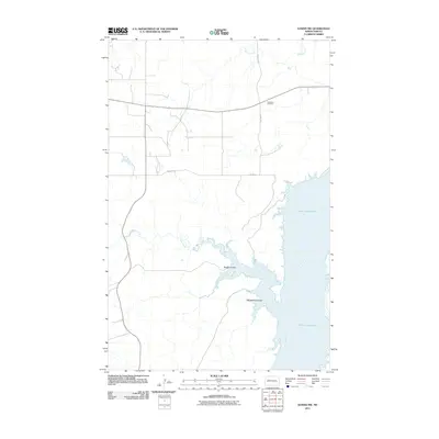
2011 Map of Sanish NW
USGS Topo · Published 2011About this map
Goodbird Cemetery stands on the high ground of the Missouri Plateau, overlooking the northern reaches of the Garrison Diversion Unit. In this early twenty-first-century landscape, the eastern edge is dominated by the massive expanse of Lake Sakakawea, where the Missouri River was impounded decades earlier. The rugged breaks leading down to the water are defined by deep drainage patterns, including Rough Coulee and Whitebody Coulee, which cut through the prairie landscape. The map shows a sparse road network typical of the Fort Berthold Indian Reservation area, centered on routes like County Rte 6 and Bia Road 2. Numerous small waterways such as Antelope Creek and Clarks Creek meander across the western half of the quadrangle, illustrating the complex hydrology of this rural North Dakota region before they join the larger reservoir system to the east.
Find a feature on this map
9 named features on this map. Tap any name to fly to it.
Don’t see what you’re looking for? This feature index may not catch every label — zoom into the map to look around manually.
Map Details
Editions of this 2011 Sanish NW Map
This is the sole edition of this map. No revisions or reprints were ever made.
Other maps of this area

1953 · Williston
USGS Topo · 1:250,000

1953 · Watford City
USGS Topo · 1:250,000

1957 · Williston
USGS Topo · 1:250,000

1957 · Watford City
USGS Topo · 1:250,000

1965 · Charlson
USGS Topo · 1:24,000

1965 · Blue Buttes
USGS Topo · 1:24,000

1965 · Blue Buttes SE
USGS Topo · 1:24,000

1967 · Watford City
USGS Topo · 1:250,000

1967 · Sanish NW
USGS Topo · 1:24,000

1967 · Sanish
USGS Topo · 1:24,000